SUNDAY
The temperature is 39 degrees but it feels like 33. We have 100% cloud cover-alto cumulous duplicatus clouds. In Field Guide to Weather it says that this type of cloud is usually related to more important weather changes and conditions. Also, they are largely composed of water droplets and are form where there is a lot of moisture. These clouds are responsible for transporting moisture over long distances. The winds are circling around a low pressure system and we are getting winds from the south. Winds are about 20mph.
The temperature is 39 degrees but it feels like 33. We have 100% cloud cover-alto cumulous duplicatus clouds. In Field Guide to Weather it says that this type of cloud is usually related to more important weather changes and conditions. Also, they are largely composed of water droplets and are form where there is a lot of moisture. These clouds are responsible for transporting moisture over long distances. The winds are circling around a low pressure system and we are getting winds from the south. Winds are about 20mph.
The barometric pressure is falling which means that we will not have clearing conditions. Since when it rises it means that rain/clouds etc. will clear, I would predict that since it is falling today that we have a chance of precipitation later today.
THURSDAY
Last night the pressure systems switched and instead of the country being under multiple low pressure systems, it is now under multpile high pressure systems. We have 0% cloud cover and little to no wind. There is a a storm on ht eeast coast that looks like it will progressively move towards the atlantic as the fronts to the west of it continue to move across the country.
WEDNESDAY
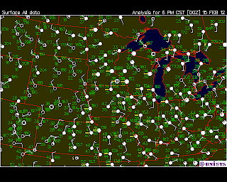
On Wednesday we had no winds and clear skies. When you look at the map of surface conditions you can see that the blue lines are located very far apart, which further shows that we don’t have wind. Surrounding areas have winds coming from the south west, and there is a cold front to the west of us.
On Wednesday we had no winds and clear skies. When you look at the map of surface conditions you can see that the blue lines are located very far apart, which further shows that we don’t have wind. Surrounding areas have winds coming from the south west, and there is a cold front to the west of us.
As the day progressed, the south west winds blew the cold front across the country and shifted the winds so that they are now coming from the north west. We ended the night with 100% cloud cover.
TUESDAY
Today we got snow. There is a low-pressure front & winds from the south. Because of the way the winds were rotating, the center of the low was above us, which is why we had snow. If the center of the low had been below us we would have had winds from the north and we would not have gotten snow.
-we discussed this concept in class; however I don’t quite understand why we get snow when the wind is coming from the south, but we wouldn’t get it if the winds had been from the north-I feel like it should be the other way.
We have a cold front moving in from the west and once it passes we’ll get winds from the northwest. We will see clearing conditions once the wind switches because it will blow the clouds through.
-You can see this on barometric history charts because if it is rising we will have clearing conditions.


No comments:
Post a Comment